The C&O Canal follows the route of the Potomac River for 184.5 miles from Washington, D.C. to Cumberland, MD. The canal operated from 1828-1924 as a transportation route. Most of the original towpath now serves as a hiking and biking trail following the Potomac River from Georgetown to Cumberland, Maryland. Many parts of the canal have been preserved and provide impressive evidence of the determination and engineering expertise of our pioneers, not the least of which is a tunnel through which the boats were towed. We chose this route for a mid summer outdoor experience and want to share it with you. Hopefully you will be inspired to plan a trip of your own along the canal route. Links to help in toward that end are in the sidebar on the left.
My eldest son Phil and I arose at 5:00 AM on July 19 in order to meet my younger son Steve and my former boss, Alan, in Harpers Ferry. After loading all four bikes onto my trailer we left their cars in the visitors parking area. We drove to Cumberland, Maryland where the bike hike was to begin. I planned the route so we would be peddling downriver. Although the river gradient is slight, I am not a "biker" and wanted every downhill advantage I could get.
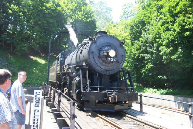
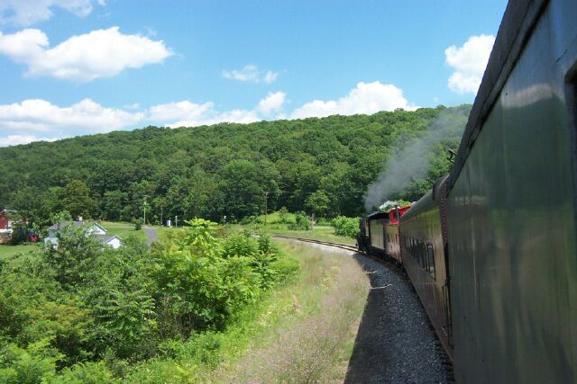
We arrived in Cumberland by 11:00 which gave us time to buy tickets and take a steam locomotive train ride to Frostburg, MD and back before beginning the bike hike. The rail line rises 1,300 feet as it snakes through the mountains and vistas, finding a tunnel of its own before reaching Frostburg. This would make a great rip in mid October when the leaves are in full color. We watched the engine whirl around on the turntable before having lunch at the Tombstone Café. We had just enough time to re-board the train before its return trip to Cumberland.
The locomotive coming off the turn table.
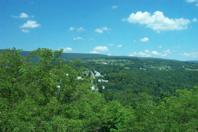
Looking out over the Maryland countryside from the train.
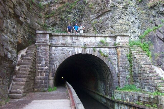
We arrived back in Cumberland at 3:30 and began our ride on the C&O Canal. We had 28 miles to go before reaching the Red Rooster Hostel in Paw Paw, West Virginia. This is a significant part of the trip, not because we could rest, shower and eat, but because this is where the Paw Paw tunnel begins. There is not much available for dinner in Paw Paw but we chowed down in a Pizza Parlor and reviewed the plans for the next day. I found I bit off a bit more than I was ready to chew. (Not the Pizza) I had 33 miles planned before lunch at Hancock, MD. I wasn't up to another 33 miles after the 28 we just completed so I opted to catch a shuttle ride back to Cumberland, get the car and meet the others in Hancock. This turned out to be a great idea as we would have the car with us along the route and would avoid the shuttle at the end of our trip. The Red Rooster Hostel was a very pleasant place to stay.
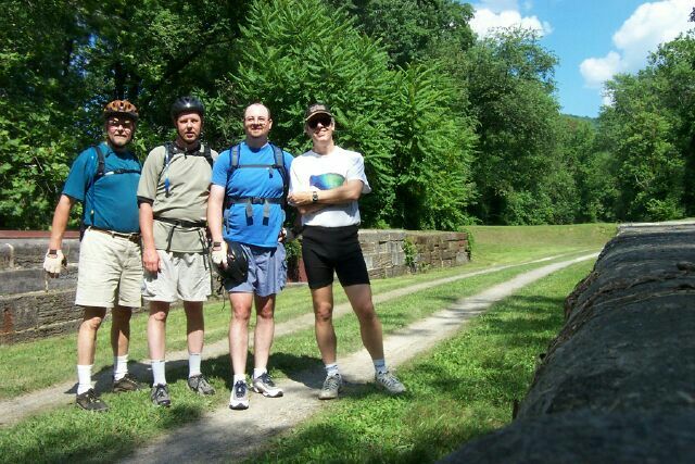
I drove to Hancock where I met the other three for lunch at the Lockhouse Restaruant. The Western Maryland Rail Trail runs through Hancock. It is paved and runs parallel to the canal for about ten miles. I chose to ride the rail trail and Alan rode the canal. After joining up on the canal trail we saw some interesting sites along the canal.
Here we are standing in the canal aquaduct where it cross over a small stream.
Before leaving on the shuttle we rode together down the trail to the Paw Paw tunnel.
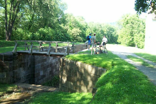
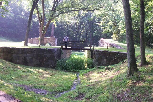
The stonework at the top of the picture took the canal towpath to a bridge over the lock. Phil is standing on a brige constructed for vistors.
The other two guys were beat from the morning's peddling, so they took the car and met us at the C&O Canal in Williamsport where I had reservations for a cabin in the KOA campgrounds. Had I known we would have the car available we would have brought camping gear and camped in one of the many campgrounds along the trail. We didn't find anyplace nice to eat in Williamsport so we drove up Interstate 81 about six miles where we found a plethora of eating places including a TGI Fridays. We all enjoyed the scenery and were well filled when we left.
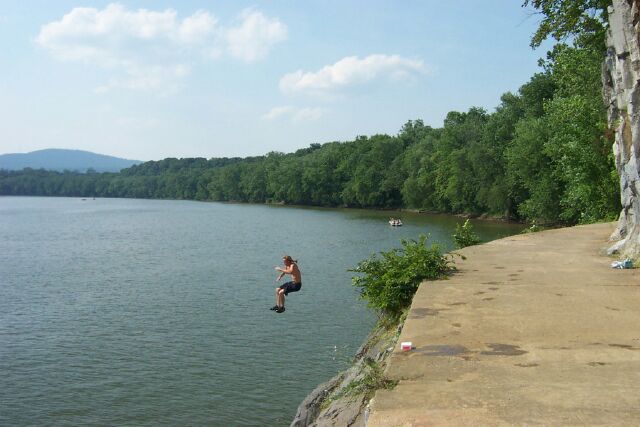
Jumping from the towpath into the Potomac River.
Monday was our last day on the trail. Alan, the veteran biker was the only one determined to peddle to our designated lunch spot in Shepherdstown, Va. We met him where the highway crossed the towpath. We didn't realize the highway was on a bridge high over the canal. We had to double back and find a road leading to the towpath. Meantime we enquired of a coed in this college town as to where we could find some lunch. The young men were very impressed with the coed. (sorry, no picture of the coed). We think she may have been both impressed and a little confused that men were asking for directions.
After lunch I joined Alan for the last 14 miles into Harpers Ferry. This turned out to be the most pleasant part of the trip as far as I was concerned. I had switched bikes and was much more comfortable with this bike. We rode our bikes across the railroad bridge to Harpers Ferry. This bridge is also part of the Appalachian Trail where it also crosses the Potomac River. We found an ice cream parlor and enjoyed some cool refreshment while we looked for the guys with the car. We eventually met up, loaded our bikes, and headed back to our respective homes. We were later to learn that Alan's car battery was dead and he had to pay for a jump-start. This is not an unusual occurrence on extended trips. The lesson learned is to make sure everybody is ready to leave at the same time.
Aquaduct over the Conococheague River as viewed from below.
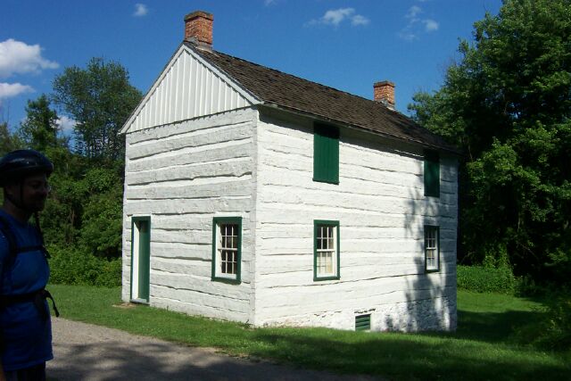
A very well preserved lockhouse. (Not the restaraunt).
A view of the locomotive heading toward Cumberland
At one point the towpath crossed over a lock. This curiosity was explained shortly as the canal terminated in the Potomac River. The river is slow and deep at this point due to a low head dam downstream. As the canal boats were towed through the river the towpath was carved out of a high rock bluff. We found a couple there getting ready to go swimming. After watching the fellow jump into the deep water we couldn't resist joining him to wash off the sweat and dust.
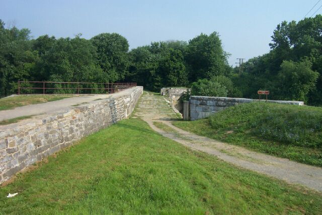
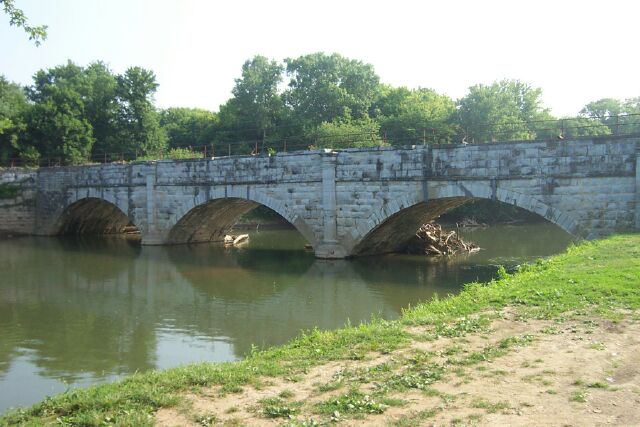
This is the trail crossing the Conococheague River aquaduct. Looking back toward Cumberland. You can see the wall on the upsteam side that was broken away.
Williamsport is where the Conococheague River crosses under the canal. In 1920 a canal boat bumped into the upriver wall. The captain saw the wall giving way and shouted to the teamster to cut the ropes to the mules. This quick action saved the team from certain destruction of being pulled into the river below. When the wall collapsed the boat was swept into the Conococheague River where it ramained for many years. The canal was repaired with a wooden wall that rotted away after the canal was no longer used.